
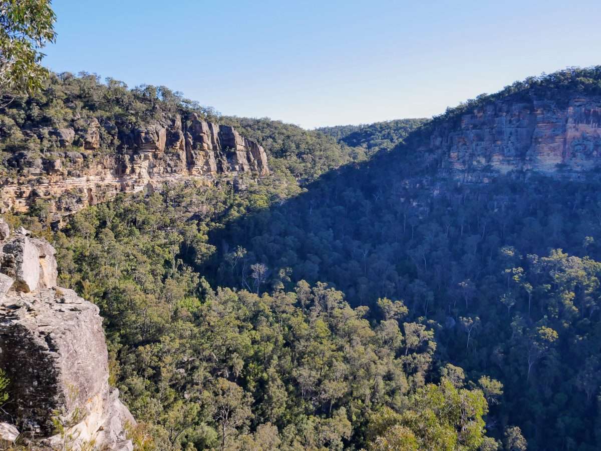
The walk to Russells Needle was one of the more challenging walks I’ve done in Australia. The views and sense of achievement from reaching the summit are worth the effort, however I found the Nattai River and Rocky Waterholes Creek to be the highlight of the walk. There are also excellent views at Needle lookout on the route down to the river, which you could visit for a much shorter day out. Definitely recommended for experienced walkers.
Challenges on the route include the sometimes overgrown Slott Way, a short section of unpleasant and steep bush bashing, and some route finding and scrambling to climb up onto the summit ridge of Russells Needle. You’ll also benefit from a head for heights on the summit itself. See my route notes at the end for details.
Russells Needle Route: The Scenery


Video from the summit:


Route Notes

The start is easy walking along fire trails, following signs for the Starlights Trail at first, but continuing past the exit for that trail to take the next right onto an impact track at an informal sign for Ahearn Lookout. (You can see the various trails on the topo map).
Slott Way
Keep an eye out for a fork in this track. The left hand option may be sign posted as Slott Way (not obvious – just a sign on the ground) which is the route down to the Nattai River. As this descended into a valley it was initially okay to follow, but became more overgrown as it levelled for a while. My best advice in this section is to hold the contour and just keep plowing forward. You will eventually lose a little height, but not much until you reach an excellent lookout. From the lookout the track descends steeply in places, but I found it easy enough to follow down to the river.
Nattai River
At the river you can enjoy a tranquil walk upstream all the way to Russells Needle. Nevertheless, without realising it I branched off onto Rocky Waterholes Creek, and found that very pleasant walking also. I’ve read that its actually an easier route because it is rocky without much water, but you will eventually have to cross back to the river. If you keep going up the creek an obvious spur/ridge will appear on your right. You’ll have to back track.
On my way out I crossed over to the Nattai River quite late and had to bush bash a bit to cross over near the start of that spur. On my way back I continued along Nattai River for a while and saw a channel that joined the two, and accessed the creek that way. My dotted lines on the map are perhaps in the middle of these two routes. Best work it out when you are there.
Russells Needle
At the obvious junction with a large side creek set off steeply up the spur through spikey bushes. This was most unpleasant, but don’t loose hope because the bushes soon thin out and the going is much easier after that. When you arrive at the summit rocks/cliffs continue beneath these on the eastern side for much of their length, until you see a fairly obvious break in the cliffs. This was approximately at coordinates 34°20’3.3288″S 150°23’25.7064″E. Scramble up here, and then walk back (north) on top of the ridge until you see the summit. To access the summit safely you can drop down to the east just a little and walk up a thin gap between rocks, which requires hands to climb up a rock step. This avoids any exposure. If you are feeling confident you could try climbing straight up the rocks, but I didn’t like the look of this.
You’ll know when you are on the summit because it is quite exposed, although there is plenty of space to sit and relax. The true summit is a very exposed square boulder which I visited using my hands for psychological reassurance, although I have seen photos of people standing on it. I certainly wasn’t up for that, (especially as I had no-one to take my photo!) Return the way you came.
I took the outward leg a bit too casually and had to rush on the way back, eventually finishing in the dark, despite an early start. So plan for a whole day out, especially in winter. Hard to estimate the distance but probably a minimum of 16km return and 700m change in elevation through sometimes rugged terrain and with navigation decisions. Some notes online involve a circuit returning via the Starlights Track, however that is typically done as two days.
The start is the same for a number of walks in the area, including the Starlights Trail, Ahearn Lookout, and Rocky Waterholes Creek Lookout.
