
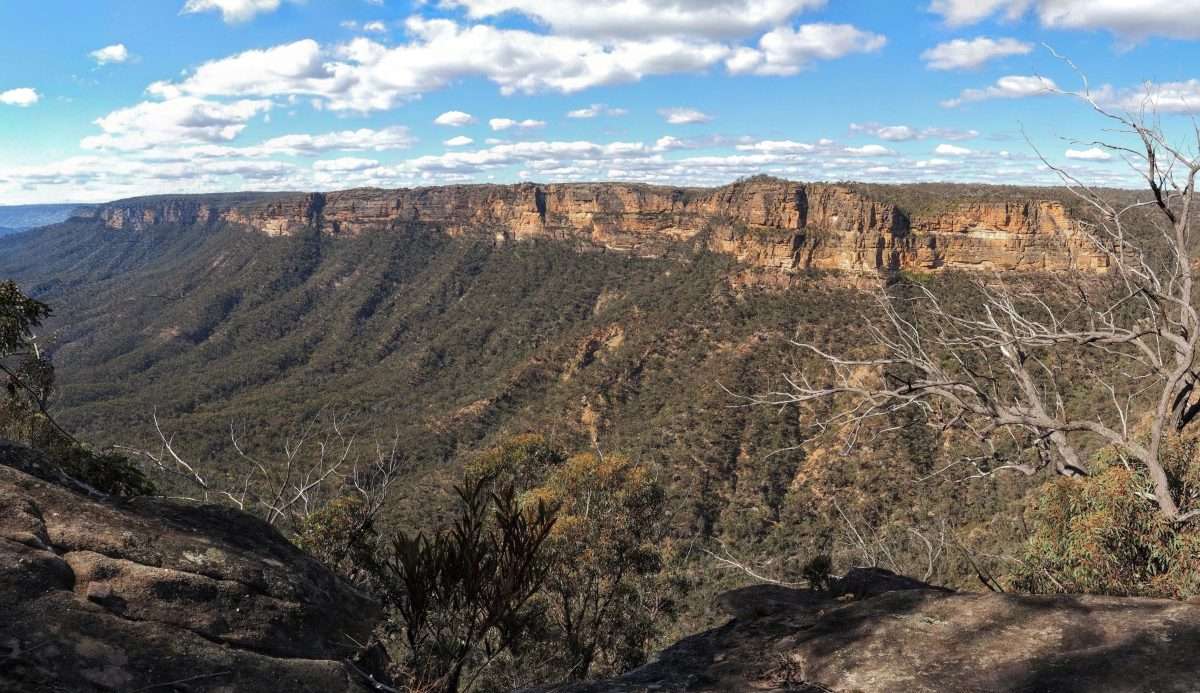
The high quality walk to Bonnum Pic in Nattai National Park is relatively unknown, and I hadn’t heard of it until just a week before I did it. The valley and cliff views are excellent, and once you get to the cliff line the walking experience is very enjoyable, walking over rocky outcrops and eventually navigating a rocky ridge.
The first hour or so is less inspiring, and the route tricky to follow for much of the walk, with some scrambling required, so it is a route for more experienced walkers. This no doubt keeps the numbers of walkers down and I didn’t see anybody all day on a sunny Saturday. Route notes at the end.
Bonnum Pic Route: The Scenery


These next few photos might be slightly out of order. I actually took some on the way back.


On my way back…


Route Notes

The walk starts just past the end of Wanganderry Road as it turns into the unsealed Wanganderry Pass Trail. The start is sign posted and there is space for one or two cars to park just before the trail head.
The first section is through forest, with old NPWS markers, although it is overgrown and still requires a little concentration. You drop down to a dry creek bed and then back up to eventually exit the forest. The route follows the edge of private property for a while, then enters the property. A fire trail takes you through forest and clearings, then abruptly becomes a foot track. Follow this to the cliff edge.
From the Cliff Line
You follow the cliff line on an undulating route over rocky outcrops and on impact tracks through patches of forest. The track is often overgrown and may be hard to follow, but it is accurately marked on the online topo maps, so have this (and GPS) with you and you should be fine.
Nevertheless, the first main navigation challenge is encountered when the trail drops down off the plateau by a creek. Look for cairns on a rock shelf to your right, then cut back left to find a way down. From there the unlikely route is roughly straight up the rocks opposite, and requires some scrambling. I kept being tempted to sidle next to the rocks, but the route was almost always a further climb upwards. There are cairns that help.
Back up onto the tops the route is still overgrown, but the land eventually narrows to a rocky knife-edge ridge. The way forward here is tricky, but is generally on top of the ridge or else down on the eastern side (to the right). There was one spot with some exposure. Again, there are helpful cairns here and there.
The final stretch to Bonnum Pic requires a short section of advanced scrambling, or at least that is how it has been described. I had a look and getting down seems fine, however I’d read getting up is difficult and a rope is recommended. I was by myself and didn’t fancy getting stuck, and I already got the views I came for, so I was happy to turn around at this point.
Navigation on the way back was still difficult and I ended bush bashing occasionally when I lost the track.
The walk is roughly 16km return. Plan to be out at least 8 hours, plus time for lunch and to enjoy the views.

I really enjoyed your review of Bonnum Pic Trail.
It was a nuanced account of a challenging and rewarding day out off the beaten track.
Thanks Christopher. As you may know this route became famous for all the wrong reasons just a few days after I walked it, so I’m happy to hear your thoughts on my write-up.
My knee was sore during that climb.